


Wadden Sea Seal Monitoring
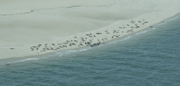
Automated seal population monitoring system using AI to count, classify, and identify individual seals from aerial imagery in the Wadden Sea.


Tracking how the Wadden coast at Wierum erodes, builds up and greens over, from drone surveys to an interactive map.
Near the village of Wierum, on the Frisian coast of the Wadden Sea, a salt marsh meets the open tidal flats. Whether that marsh edge grows seaward or retreats tells coastal managers a great deal: salt marshes damp incoming waves, trap sediment and form a natural first line of defence in front of the dikes that keep the land behind them dry.
Together with Rijkswaterstaat and Lumax AI, we built CODAP, the Coastal Data Portal: an end-to-end monitoring pipeline that turns repeated drone surveys of this coast into maps of land cover and elevation change, and serves them on an interactive web portal anyone can explore in a browser.
The Wadden Sea, a UNESCO World Heritage Site, is the largest unbroken system of intertidal sand and mud flats in the world. Its edges are working landscapes as much as natural ones.
Salt marshes absorb wave energy and trap sediment, sheltering the dikes behind them. A healthy, growing marsh is cheaper and more resilient than concrete.
Whether marshes and mudflats can keep pace with sea level rise depends on their sediment budget. Only long-term measurement shows which way the balance tips.
Mudflats and marshes feed millions of migratory birds and act as a nursery for fish. Tracking their extent tracks the health of the whole ecosystem.
Watching a coastline change sounds simple. Doing it rigorously is not. Tap each challenge to see why.
The marsh edge shifts with every storm, tide and season. A single survey is a snapshot; understanding the trend takes repeated, comparable measurements over years.
Erosion and sedimentation often amount to a few centimetres of elevation change per year, invisible to the eye but decisive for how the coast evolves.
Tidal flats and salt marshes are only accessible in narrow tide windows, and walking surveys across soft mud are slow, exhausting and risky.
Each drone flight produces an orthophoto with billions of pixels. Mapping vegetation, mud and sand by hand at that scale is simply not feasible.
Comparing flights only works if every survey is classified the same way, regardless of season, lighting or water level.
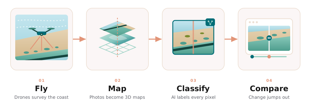
Every few months, a drone surveys the site and the imagery is processed into two precise products: an orthophoto, a distortion-free aerial image of the whole site, and a digital elevation model that records the height of every point on the marsh and flats.
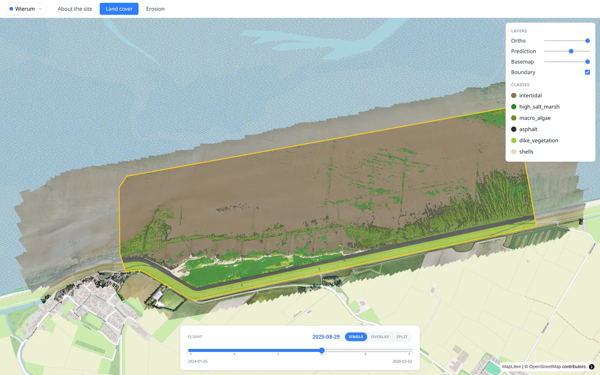
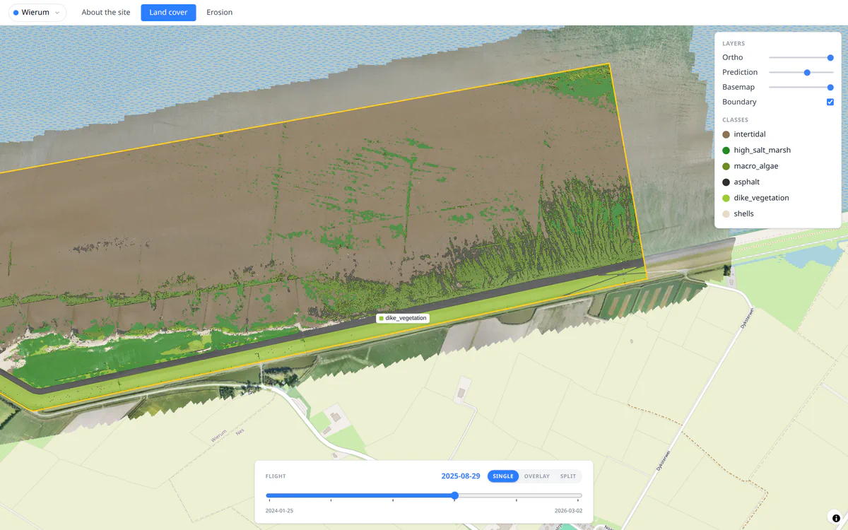
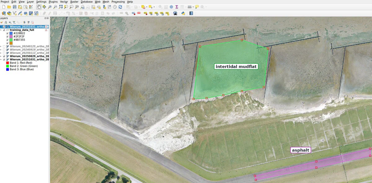
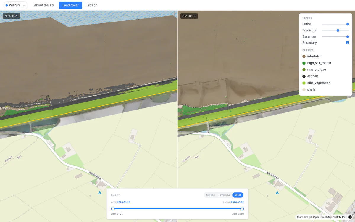
A semantic segmentation model then classifies the orthophoto pixel by pixel into coastal land cover types such as intertidal mud, salt marsh vegetation, macro algae, shells and the built surfaces of the sea dike. The model learns from examples: ecologists outline patches of each class on the drone photos in QGIS, following a 44-class annotation scheme designed with coastal ecologists and organised on three levels, from broad zones such as salt marsh down to individual plant species. The current model maps six of these classes, and new ones are added as more examples are labeled.
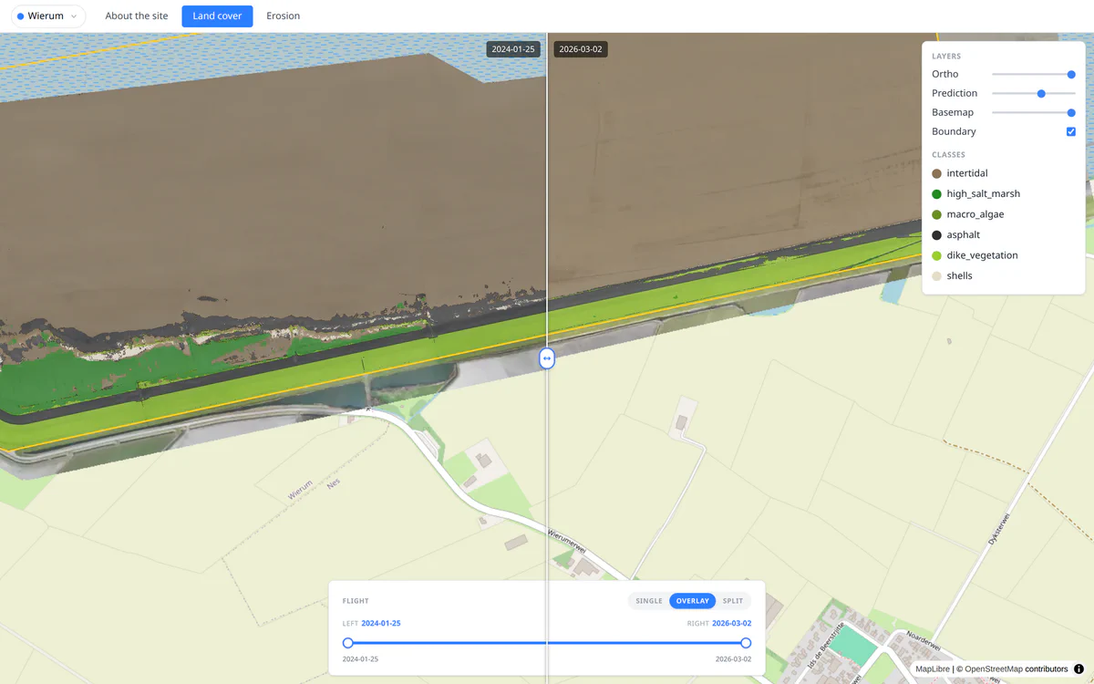
The predictions, orthophotos and elevation data are published as map tiles that the CODAP portal streams straight to the browser. No GIS software needed, just a link.
The heart of the portal is comparison. A timeline slider picks any two flights, and three view modes make the differences jump out: a swipe handle you drag across the map to reveal one date beneath the other, a side-by-side split view that pans and zooms in sync, and a single mode for studying one survey in depth.
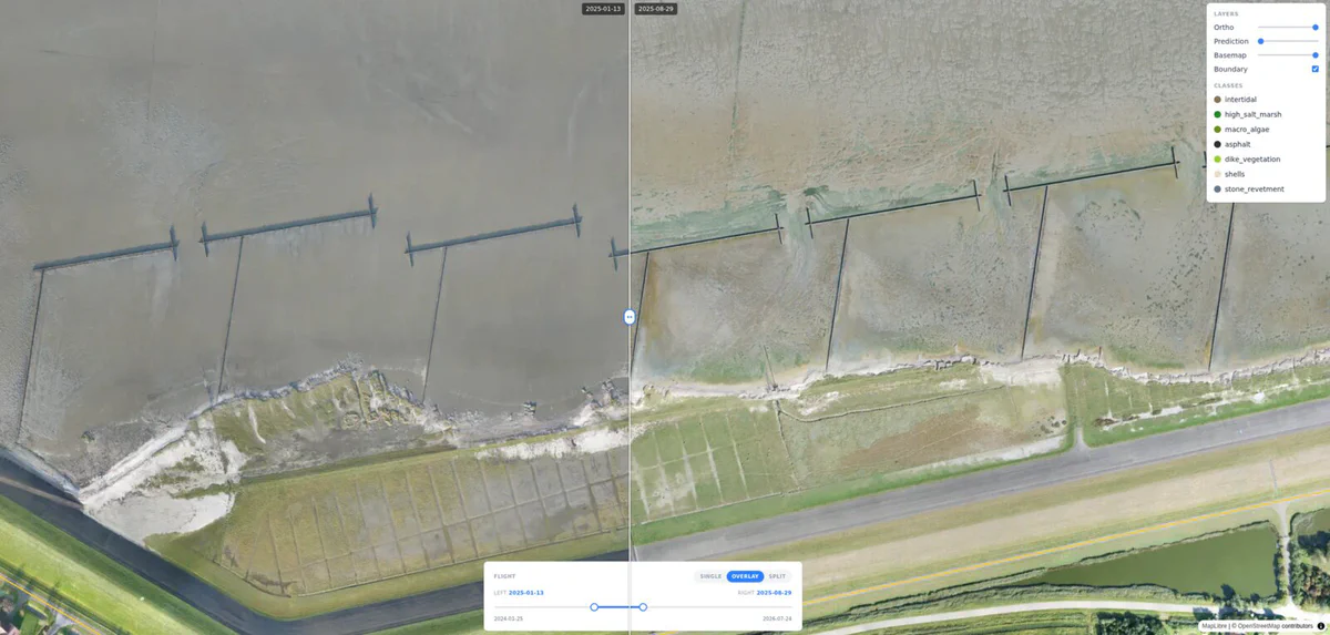
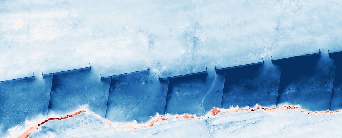
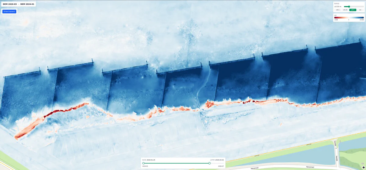
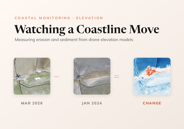
Land cover tells you what the surface is; elevation tells you where it is going. By differencing the elevation models of two flights, the portal computes a change map of the entire site: blue where sediment has accumulated, red where the surface has eroded, at centimetre resolution.
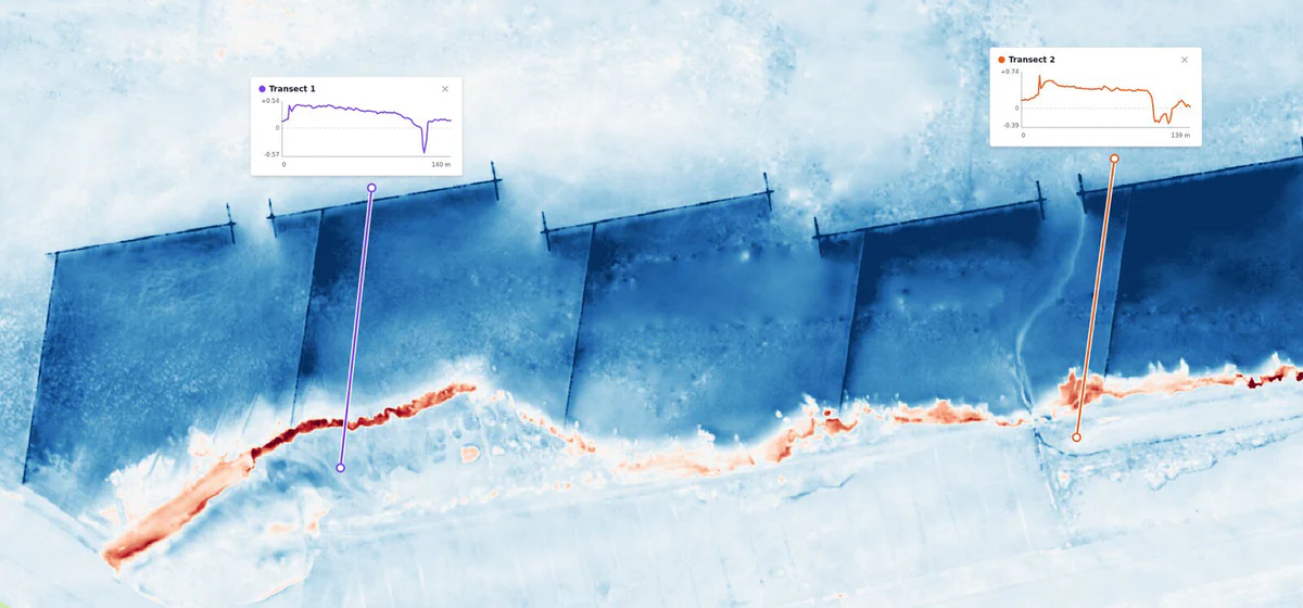
Patterns that would take years of ground surveys to establish become visible at a glance: between January 2024 and March 2026, much of the flats in front of Wierum rose by 10 to 50 cm, while a narrow band along the marsh edge dropped by up to about 50 cm. With Draw transect, anyone can draw a line across the map and read the profile of change along it.
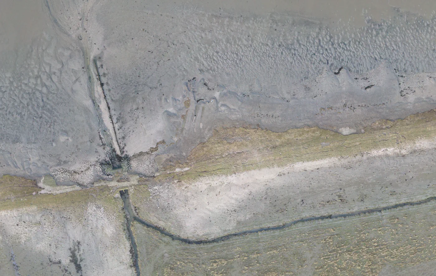
This also makes it simple to judge coastal protection works. At Wierum, a structure was built to protect the marsh cliff from erosion: the change map and transects show within minutes where sediment is building up and where the cliff is still eroding, pointing directly to its weak spots.
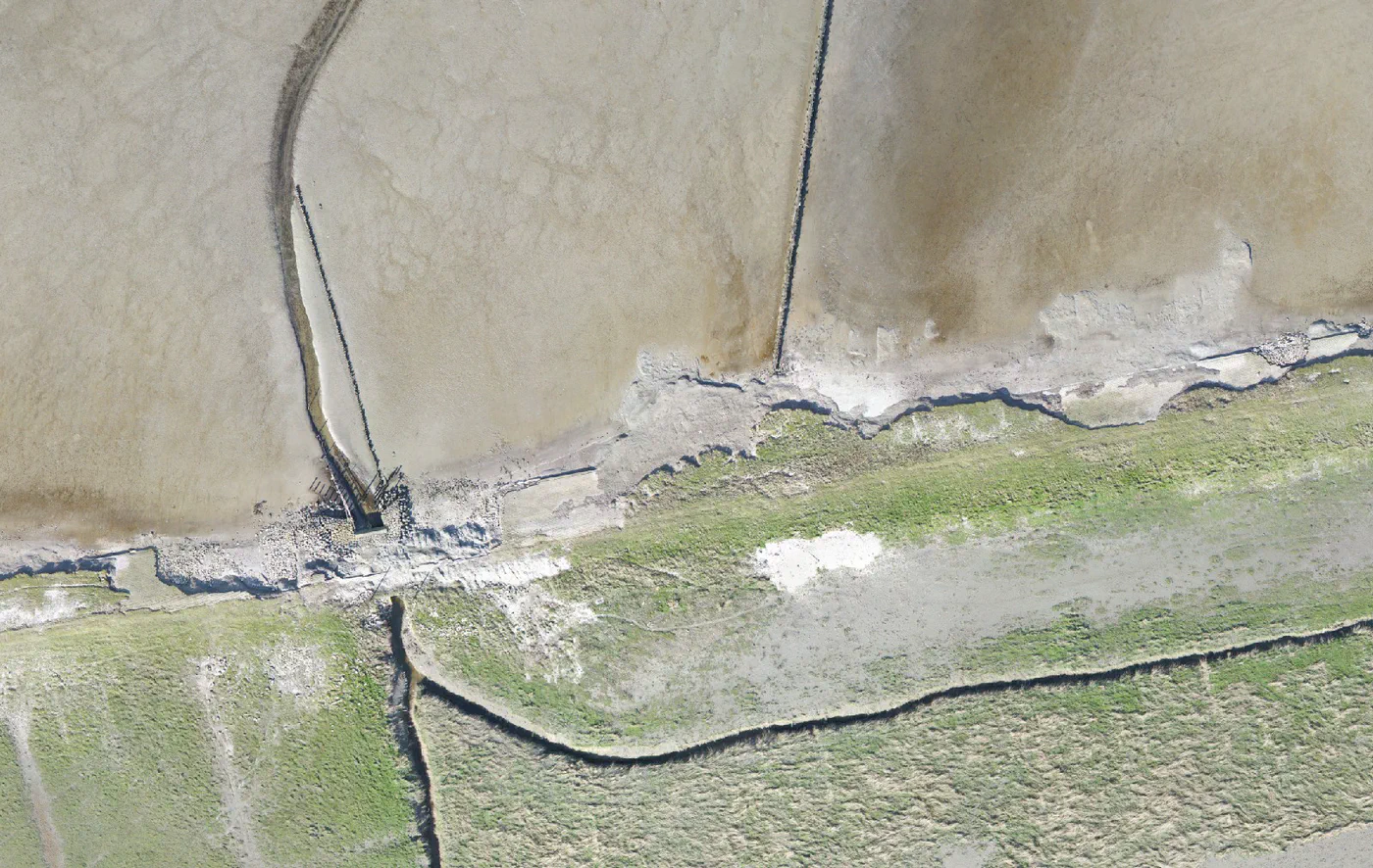 Jan 2024
Mar 2026
Jan 2024
Mar 2026
CODAP turns coastal monitoring from an occasional, labour-intensive campaign into a routine: fly, process, publish, compare. Every survey lands in the same portal, classified the same way, comparable with every survey before it. Coastal managers at Rijkswaterstaat can watch the marsh edge evolve at centimetre precision without leaving their desk.
Wierum is only the beginning. The portal was built multi-site from day one, and we intend to expand it to more sites along the Wadden Sea coast and to coastlines in other countries: the same pipeline of fly, map, classify and compare applies to any shore a drone can survey.
The bigger idea is preparedness. As sea levels rise, decisions about where to reinforce dikes, restore marshes or let nature take its course all depend on knowing precisely how each stretch of coast is responding. By making that evidence continuous, affordable and easy to read, CODAP helps coastal communities prepare for and adapt to the rising sea rather than react to it.
The CODAP portal is public. Pick a flight, drag the swipe handle, and watch two years of coastal change unfold in your browser.
Open the portalWe build conservation technology with partners in the field. Tell us what you're monitoring and we'll tell you what's possible.

Automated seal population monitoring system using AI to count, classify, and identify individual seals from aerial imagery in the Wadden Sea.
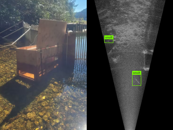
An innovative use of sonar imagery to monitor and analyze the migration patterns of smolt salmon as they journey from freshwater to the ocean
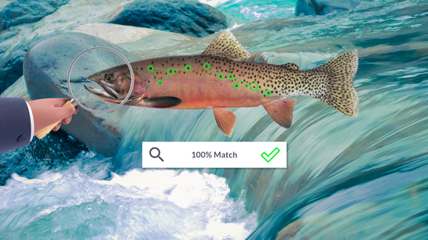
Non-invasive technology for monitoring trout populations using computer vision to accurately identify individual fish.
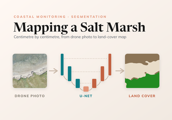
How we trained a U-Net to map land cover on the Wadden Sea coast from drone photos, from ecologists' labels at any level of detail to a seamless map of every survey.
How CODAP measures erosion and sedimentation on the Wadden Sea coast by differencing drone elevation models, cleaning out the noise without losing real change, and reading the result with transects.
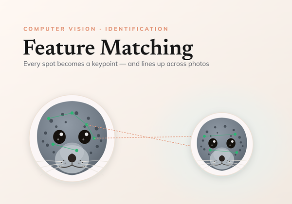
A comprehensive examination of using local feature matching for individual identification.